By Frances James (1922 – 2019)
From Proud Heritage, Volume III by DCPA. This 352 page hardcover book is available elsewhere on this website.

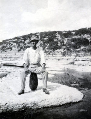
Photo Courtesy Eva Potter Morgan

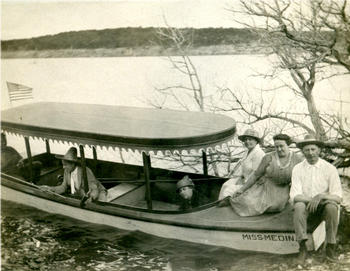
Photo Courtesy Chris Thevenet
The beautiful waterway named White Rock Creek begins in Collin County north of Highway 121 near Hillcrest and passes near what we now recognize as the town of Addison. It cuts through the Preston Witt survey, about where Belt Line Road and Preston Road intersect. (Preston Witt spoke at the first meeting of the DCPA in 1875; he was an active pioneer, serving in the Indian and Mexican wars, and his family operated the steam mill on Trinity Mill Road.)
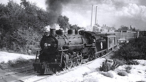
White Rock Creek then cuts toward what is now Coit Road. When the right-of-way for the Houston & Texas Central Railroad was purchased in 1872, the owner of the property on the Creek made a deal with the Railroad to sell water rights. Water was important, as the early trains were pulled by steam engines.
Medical City Hospital on Forest Lane is just across the street from the Creek, which has been controlled in this area with concrete sides. The park that borders the Creek in this area is called Anderson Bonner Park. Bonner was another pioneer black entrepreneur; he could not read or write, but was able to purchase small pieces of property as they became available before the turn of the century. His first purchase was made in 1874; also land not particularly good for raising cotton. His descendants still live in and around Dallas, and they are not poor.
As the Creek meanders toward what we now know as White Rock Lake, it passes the community called Fisher, about where Mockingbird Lane crosses the Railroad. Another pioneer cemetery in the area, the Cox Cemetery, named for the man who maintained it for many years, still has headstones of the McCommas family (Elder Amon McCommas, first chaplain of the DCPA, was also at that formative meeting).
After the great flood in 1908, when the City of Dallas realized they needed a better water supply than surface wells and the Trinity River, a hydraulic engineer named Chester Davis recommended that White Rock Creek be dammed. The spillway was completed by the Fred Jones Company in 1911 for $260,000, on 2,291.9 acres of land the City had acquired along the Creek for $178,420. The location required only one lift of the water to enter the City’s mains. The Pump Station built in 1911 was renovated in 1990 and is used by Dallas Water Utilities as an operations center, and the Filter Building constructed in 1923 next to the Pump Station is still used by the Water Department.
White Rock Creek begins again at the spillway of White Rock Lake and continues on until it meets the Trinity River in southeast Dallas County. Starting about where the spillway is now one of the C.A. Lovejoy Surveys. Lovejoy was a half-brother of Warren Ferris, a young self taught surveyor who surveyed the boundaries of Dallas County. Some sort of law said that the surveyors could not claim the property they surveyed, but Ferris recognized the most choice land along the Creek, and even back in the 1800s there was “more than one way to skin a cat;” he just put the land he wanted for himself in his half-brother’s name!
The next owner on the map is Jacob Buhrer, on a spot noted as a dairy, of which there were many in the wide flood plain. Anna Hinterman and Jacob Buhrer came to Dallas County in 1879, and their first dairy was near the confluence of Fitzhugh-Carroll and Junius. When they needed to expand, they chose a 200 acre site on the west side of White Rock Creek. The family continued to operate the dairy until they were forced to sell the land for the spillway and dam in 1911. In 1985 there were eighty-five direct living descendants of the family still in Dallas, including our late Louise Buhrer.
The Creek next passed land which is now nearly all within Tenison Park and the Golf Courses. Early families who lived on that Survey were the W.J. Rupard, T.I. Wood, Mrs. M. Cobb, and J.L. Ferguson, who had a road named for him. Much of that land had been in the possession of Dr. W.W. Samuell until the 1920s, and he sold part of it to the E.O. Tenisons, who donated it to the Dallas Park Department as a memorial to their son who had died as a young man in the influenza epidemic.
When the Texas & Pacific Railroad came to Dallas in 1873, the look of wide open spaces had changed. It crossed the East Fork of the Trinity east of Dallas and White Rock Creek near what is now the confluence of Forney Road, Dolphin Road, and Military Parkway. Some of the right-of-way was purchased from the Becker family dairy, then about where the Fire Department Training Facility is now. They had purchased their land from the John Beemans. The Beemans, a large family of children, men and women, settled on a 640-acre site they thought to be free, only to find that it had already been surveyed and assigned to Thomas Lagow. Rather than move, they purchased the land for $1 an acre from the widow of Thomas Lagow. Beeman set aside what he said was the prettiest place on the farm for the cemetery.
A description of what Scyene Road was before finally being improved early in the twentieth century, was given by a local citizen: “Going to Dallas was impossible when it rained because you could not get across the creek. The sides were steep and the white chalky dirt was slick when wet. The wagon trail consisted of a low water crossing of logs that had been laid crosswise. I was so afraid we would slide off. Another local citizen told about delivering milk from the Sanger Brothers’ farm his father had rented: We covered the milk cans with wet sheets to keep them cool in the summer time. If it rained while we were in town we just had to stay at the wagon yard and sleep in our wagon until the creek went down so that we could cross and get back home.”
The Creek is a natural state below Scyene Road, a wetland area that has never been developed. It has flooded in the past, but provides a beautiful open space with grand old trees. Dallas Power & Light built a lake in the early 1950s, which is one of the few sites designed to produce electricity by natural gas! Another site in the vicinity is the Dallas Park and Recreation center, on land donated by the late Mayor Annette Strauss and her husband. Adjacent to the facility is a high bluff looking across the flood plain, where the late Congressman Hatton W. Summers had a large farm. From his vantage point he could see downtown Dallas.
The Grover Keeton Golf Course was built in the 1970s with money procured through Community Development Funds. (Grover Keeton was a past Parks and Recreation Director.) At times the Golf Course has been closed due to high water; some method of preventing expensive flooding could be arranged without damaging the natural flood plain.
On the east side of the Creek, below Highway 175, the flood plain has been owned by the Pemberton family for over one hundred years. It is the source of the big spring which has never gone dry. John Neely Bryan and his wife lived there in a cabin until he had to be sent to the Insane Asylum in Austin.
That area is near the confluence with the Trinity River, and those of us on our canoe trips down the Trinity were able to see the meeting of waters.


